Yesterday, I visited Dent’s Meadow, the spot where John Wilkes Booth and David E. Herold first set across the Potomac River. What follows is the short video clip that I made while standing on that Maryland shoreline:
Further images will come later as I complete a Crossing the Potomac Picture Gallery. In the meantime, here is an animated image of the spot in 1901 and now:
EDIT: One reader was a little confused regarding the location where I shot my video versus the location of Henry Woodland in the photograph taken by Osborn Oldroyd in 1901. I created this little map to hopefully alleviate that confusion:


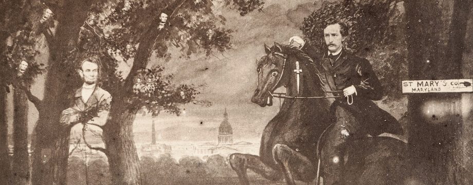
Great idea to superimpose the woodcut of Booth & Herold over Dent’s Meadow! I am confused and disoriented, tho, about those piers in the water. . Your clever back n forth shots of Henry Woodland standing there, then and now, shows a pier jutting out on the north end of Dent’s Meadow. But it’s not there in your video! I don’t get it. A similar pier stands on the south end of Dent’s Meadow in your video. Please help me to figure this out!
I just added a map to the post that should clear everything up for you, Richard.
Another fantastic travelogue, Dave! Did you find it difficult to get down to the shore (and back up)? Was it difficult to get permission from the Jesuits? Great job with the photos.
Thank you, Steve. I had actually visited the shoreline the day before I shot this video. Sadly, on that trip I had come during high tide and there was hardly any beach for me to walk on to get to the correct spot. I consulted a tide chart and came back the next day. The Retreat House was very kind and once I explained my reason for visiting they were gracious enough to let me visit, provided I didn’t disturb the retreat participants. There is a partial path for some of the way down but it is certainly tiring coming back up.
Dave – I trust you are now scouting around for a 14′ flatboat, a compass and waiting for a dark and dreary night…….
When (New Jersey Shakespeare Festival Theatre founder and Artistic Director) Paul Barry and I sailed (quite close) past the Indiantown Farm slave cabin in 1989, it was a complete ruin and we could see that there was very little of the structure (additionally) to see by making landfall there that we couldn’t see from the water. I did, however, take a photograph or two of it from the Sunfish sail boat in which we traversed the entire 22-mile JWB Potomac River portion of the escape route that time. Also, like King’s Creek, the site was unsuitable for the campsite that we were seeking since both the structure itself (unlike now) and the King’s Creek shoreline were almost completely overgrown and surrounded with underbrush and tree growths.
I believe (as did our advisors, Mr. James O. Hall and Mike Kauffman at the time) that The Guys went all the way up and into Burgess Creek and made landfall there; hence, our making camp in 1989 at/on the piece of land between Gumtree Cove and the creek itself which was so completely silted up that a boat could not be taken into it. Otherwise, Paul and I would have camped a little farther up and further into the Burgess Creek area. Close enough and as near to the JWB/DEH area as we could get, though.
Paul and I, I believe, only sailed past (the very narrow) Gambo Creek in 1989 following our overnight stay (in a small but quite comfortable pup tent at the Gumtree/Burgess site in 1989) but we subsequently encountered the same silted up problem (as at Burgess) approximately 100 feet or so into Gambo Creek when we boated into it (also taking photographs the entire time) in 1990 on a return exploration of the Virginia shore and Machodoc Creek portions of the escape route via (a superb) Canadian canoe that the owner of the Aqua-Land Marina adjacent to the Harry W. Nice Bridge on the Maryland side was generous to loan us – complete with paddles and life jackets – free of charge for several days for our JWB research. At present, one can only view Gambo Creek (except from the Potomac) from a very easily-missed area at the side of Route 301 through a Dahlgren Weapons Laboratory chain-link security fence – which still is a nice view, though.
We also were not able to access the area where the large tree was where DEH left JWB alone for a while during Herold’s initial visit (also alone) to Mrs. Quesenberry’s informing her that they were there and needed aid. The site where the tree once stood is on the grounds of the (restricted access) Dahlgren Weapons Laboratory area and is where the large communications tower at the D.W.L. is now situated
I recall that Mr. Hall was particularly interested in seeing the photographs of the Potomac River JWB-related sites that I took from the river during our 1989 and 1990 excursions and had asked me (beforehand) to take as many photographs from the water as I could (and which I did) since he had no from-the-river views of the sites in his files at the time.
Robert W. Cook
Bryantown, Maryland
10 August 2013
I enjoyed Bob Cook’s posting because I still have some reservations about the layout of Indiantown Farm. Do we have any indication that the current house with the great view dates to 1865? Unless there is a smaller structure hidden underneath all those layers (as is the case with Mrs. Quesenberry’s “Cottage” today), I think we need to do more investigation.
I also have reservations about the current “slave cabin” being a slave cabin at all, even if it was there in 1865. I thought the exact same thing when I first saw the dilapidated version that Mike Kauffman found years ago. Frankly, it was just plain too big. Slave cabins in Southern Maryland were typically one room dwellings – even if occupied by several families. To have an enclosed stairway to a second floor would also be unusual. A “second floor” was usually a loft area with a ladder and very meager floor space extending about half-way over the first floor.
The catslide roof configuration also concerns me as being atypical of a slave cabin. The vertical siding that is on there now is certainly not original and is more typical of German siding that came into vogue in this area post-Civil War. It also seems to be too close to the main house (if both of them are on their original sites).
I just have a feeling that this cabin post-dates the slavery period in Southern Maryland and was most likely a tenant house. When I was growing up, our family owned several farms that had four structures very similar to this (but with a regular second story roof). The three steps up to the door to get upstairs was in each and every one of those structures (all built about 1880) and was generally tucked in one corner of the common room or the kitchen. All of our tenant houses were two rooms down and two rooms up.
Dave – I just realized that I should have posted this under the Indiantown Farm section. Can you make the change?
I must apologize on one thing about the construction of the cabin. I don’t know why I thought the siding was laid vertically in German style. It is traditional horizontal mounting. Most early cabins were log and daubing construction, however.
I’m a student, and I’m doing a map project (on Google custom maps) about the escape of John Wilkes Booth. I really loved your video, so I copied the URL and put it in my map. Thanks for the help!
I’m glad I could help, Eden. Thanks for reading/watching!
Dave
Henry woodland- any other biographical material? descendent of Henry woodland- Dr. Carolyn Woodland Boulware of Princeton Junction, New Jersey born to Philip Henry Woodland (1901-1981), Charles County, Maryland. His father was James Henry Woodland born in1868 in St. Mary’s County- First Black Bailiff of Charles County – In Osborn Oldroyd’s Book,The Assassination of President Lincoln,Henry Woodland was interviewed by Oldroyd but nothing said about his personaLlife. I spent almost a year trying to find out more about Henry Woodland.
You must be mistaken about Allen’s Fresh being the original intended crossing point. Allen’s Fresh makes no connection to the Potomac except via the Wicomico river, many miles down the Potomac from your video. I believe you possibly meant Pope’s creek.
In Dave’s defense, the boat for the kidnap scheme was actually hidden at King’s Creek, a tributary of the larger Nanjemoy Creek and near the Hughes farm, where Booth and Herold accidentally came back to on their first attempt to cross the Potomac after the assassination.
The area around Allen’s Fresh and the adjacent Wicomico River had been part of the blockade-running trails during the CW, so it might have been a viable route. It was part of St. Mary’s County “traffic,” not Charles County’s. Pope’s Creek was not the only crossing point – it just became such when the fugitives were turned over to Thomas Jones.
Remember that Union forces hightailed it into St. Mary’s when it was reported that two men had been seen on the Potomac at that point. Those two were very likely Thomas Harbin and Joseph Baden, acting as decoys.
The false report at Great Mills ended up being a man dressed in women’s clothing. Harbin and Baden had already crossed the river into Virginia on April 16th, when they left from Banks O’Dee (near Swan Point, right across the river from Machodoc Creek). It was this crossing of Harbin and Baden on the 16th that eventually got the 16th New York into the northern necks of Virginia looking for Booth and Herold.
My source for the original crossing point by way of Allen’s Fresh and the Wicomico River comes from Michael Kauffman’s American Brutus (Page 287):
“Thomas Jones had hoped to take the fugitives to Allen’s Fresh, where the Zekiah Swamp empties into the vast tidal flats of the Wicomico River. The Potomac just beyond, is six miles wide at that point, but gentle currents there made boat crossings relatively easy. There was just one problem: authorities had the place under constant surveillance. After several days of keeping his ear to the ground, Jones finally gave up on Allen’s Fresh. On Wednesday, April 19, he told his servant, Henry Woodland, to bring back the rowboat he had been keeping there, and to leave it in the small creek near Jones’s farm, known as Huckleberry.”
Kauffman cites Henry Woodland’s 1865 statement regarding bringing the boat up from Allen’s Fresh which is contrary to Jones’ later statements that the crossing point was always Dent’s Meadow. However, Dent’s Meadow never would have been a good point. From Dent’s to Mrs. Quesenberry’s home is an 8.5 mile row diagonally across the Potomac in a rough area of currents. While the Allen’s Fresh crossing would have meant more rowing, the Wicomico River is a much easier row and, as Kauffman states, the 6 mile row across the Potomac down there would have been far easier than what they ended up doing.
The direct water route from Allen’s Fresh to the shore of Virginia via the Wicomico is a distance of about 20 miles. The Potomac at the mouth of the Wicomico is no picnic either having terrible winds at times, especially in the spring. I live on the shores of the Wicomico and regularly boat the area and that would be quite a row. I suppose it could have been done in a few days.
I just finished Oldroyd’s book so I find this all very interesting to me since I live so close to where it all took place.
If my memory serves me correctly, several of our Booth escape historians have attempted the Dent’s Meadow crossing over the years. The intrepid John Brennan, Richard Sloan, and Father Keesler tried it in the 1970s and were caught in a sudden storm halfway out. They skedaddled back to shore, even bailing the boat along the way.
I believe that Mike Kauffman tried it in the 1990s and encountered very strong currents that impeded speed greatly. I’m not sure whether or not he ever made it to the Virginia shore. A recent film crew was heading there when they left Surratt House. They had arranged for a motor boat to trail them just in case and to carry a life guard. Mike was their guide for the expedition.
Booth and Herold certainly made it in less than a day and under the cover of night and avoiding Union patrol boats. I have a family member who lives on the Wicomico and boats and jet skis out into the Potomac and into Virginia outlets all the time. Naturally motors help, but all I have ever heard him say is to agree with Mike Kauffman that the currents in the Potomac are much worse at times than one would expect.
PS: It is a beautiful area…